
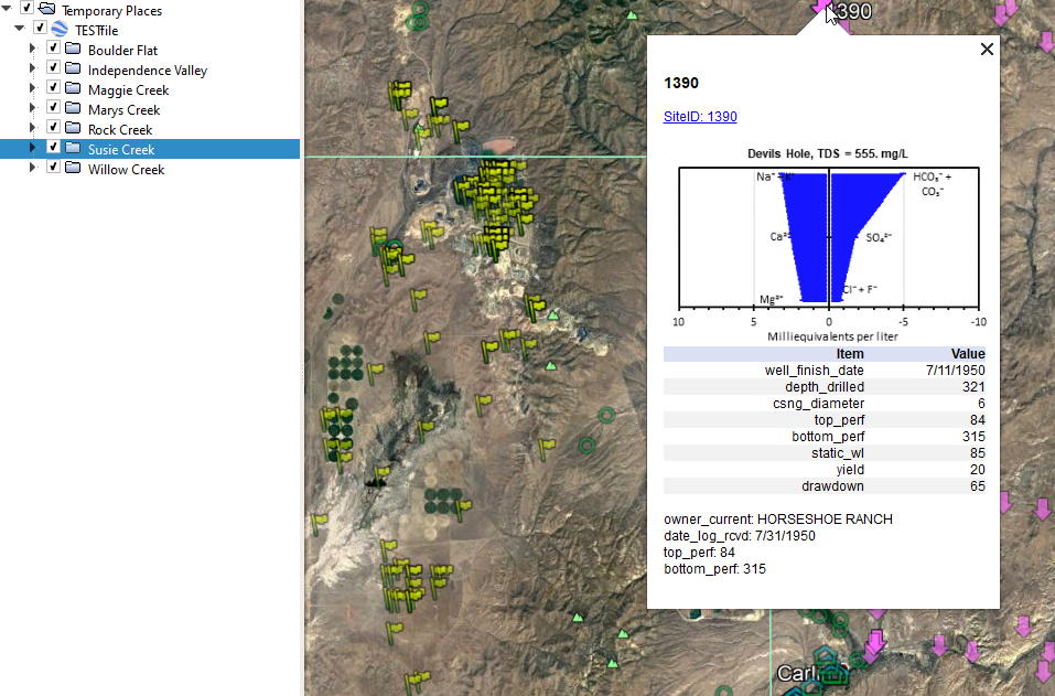
Wells, precipitation, and other sites can be mapped with ancillary information in a KML file with the KML_WritePoints workbook (Figure 1). Sites can be grouped in folders to control visibility and ancillary information can be accessed through the descriptive balloon for each site. Ancillary information can include hyperlinks, images, two-column data tables, and descriptive text (Figure 1). Order and type of ancillary information are user defined.
KML_WritePoints.v3.xlsm, KML_WritePointsPrecip.v3.xlsm, and explanatory PDF can be downloaded with the following link.
VBA macros & Trust Center
More macro functions default to being disabled through either Microsoft updates or IT departments engaging in their natural function. Please check your Trust Center settings.
Download
Revisions
August 5, 2021—Revisions in version 2 include the following. Examples and explanation files created.
August 23, 2022—Revisions in version 3 include the following. Error in functions sRGB and sAlphaBGR corrected so that hexadecimal color codes are written correctly in KML files.